
Upper Arlington ZIP Directory Coverage
Three ZIPs are verified as serving Upper Arlington mailing addresses: 43212, 43220, and 43221. The evidence is address-specific and postal in nature. It does not show that every delivery address within one of those ZIPs is inside the City, or that every City parcel shares one postal label. Treat each row as an Upper Arlington mailing-use reference, then use USPS for an exact address.
| ZIP | Areas Covered | Post Office | Notes |
|---|---|---|---|
| 43212 | Verified Upper Arlington mailing use at UAPL Miller Park Branch, 1901 Arlington Ave. | Not verified for this ZIP in the researched local or USPS sources | Formatted as Upper Arlington, OH 43212; postal use is not a City-limit boundary. |
| 43220 | City planning map and City address examples place this ZIP in Upper Arlington contexts. | Not verified for this ZIP in the researched local or USPS sources | Verify each mailing address with USPS; the planning map is not a USPS boundary source. |
| 43221 | City planning map and City Hall use show Upper Arlington mailing use. | USPS identifies the Upper Arlington Post Office at 3700 Riverside Dr. as COLUMBUS, OH 43221-9998. | City Hall uses 43221; the postal city label does not define municipal jurisdiction. |
The City’s own material makes the split visible: Miller Park uses 43212, City examples use 43220, and City Hall uses 43221. The verified post-office detail is limited to the USPS description of the Upper Arlington Post Office. No separate post-office assignment for 43212 or 43220 was verified in the research.
Upper Arlington Postal Check
USPS is the final authority for formatting a particular mailing address. County and City records can explain a parcel’s geography, but they do not replace a postal lookup. This matters locally because the Upper Arlington Post Office is described with a COLUMBUS postal city format, while the City has documented Upper Arlington mailing examples in three ZIPs. A postal-city string is not a finding about City limits.
Use the USPS address lookup after collecting the complete address. If a postal result and a property or City label differ, retain each for its own purpose: USPS for mail delivery, the parcel map for land location, and City records for municipal context.
Upper Arlington ZIP Filters
Franklin County Auditor Advanced Search includes a ZIP Code criterion. It permits multiple ZIP values when they are comma-separated with no spaces. That makes the search useful for narrowing a property set, but every returned record still needs a parcel-level check. The same Property Search navigation also exposes Owner Name, Address, Parcel ID, Subdivision & Condo, Advanced Search, Map Search, and Intersection Search. Select the mode that fits the question rather than treating ZIP as the only address key.
| Property-search control | Verified use and limit |
|---|---|
| ZIP Code | Available in Advanced Search; several values can be entered with commas and no spaces. |
| Address, Owner Name, Parcel ID | Separate search modes for a known address, owner form, or parcel identifier. |
| Subdivision & Condo, Map, Intersection | Additional visible modes; Historic District and Subdivision criteria had an upgrade-related availability notice. |
| Parcel Viewer By Value | Uses a map layer and field, including annexations, rather than treating ZIP as a City boundary. |
See the Auditor Advanced Search before using the ZIP criterion.
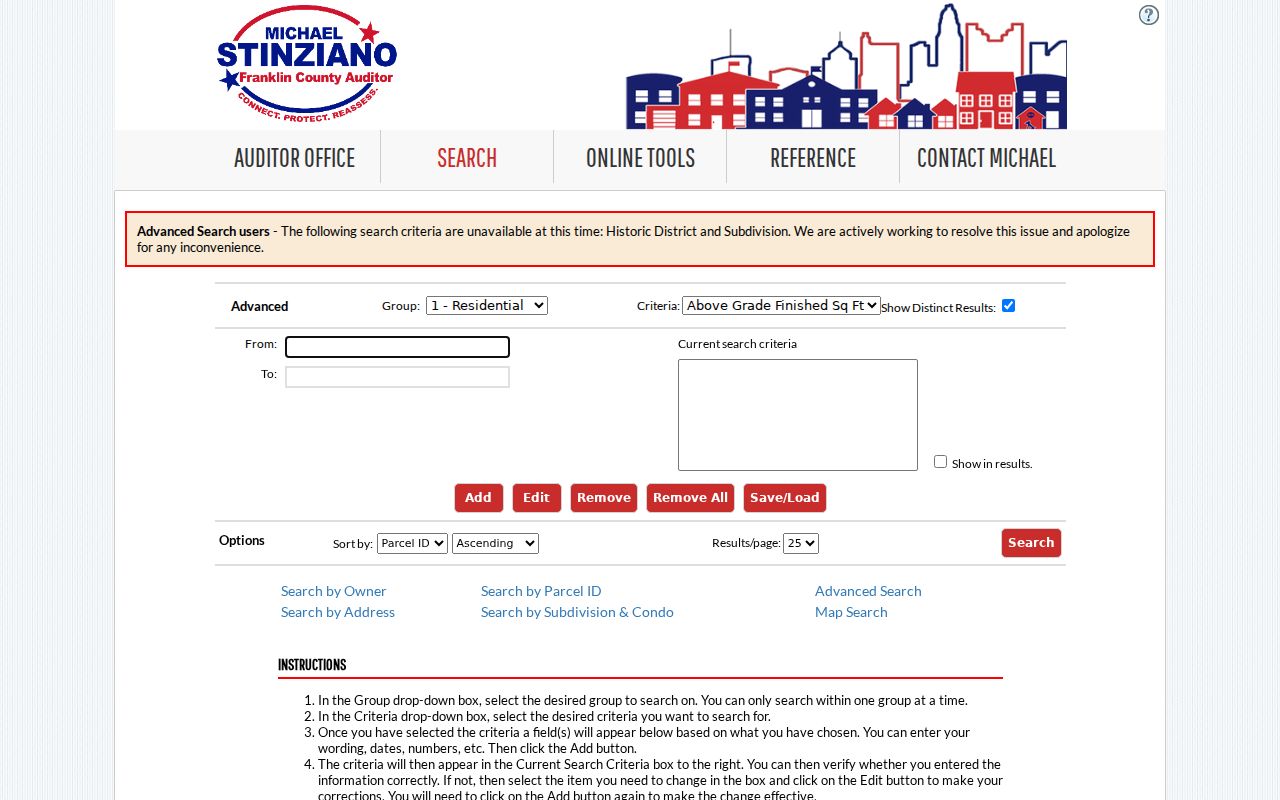
The captured Advanced Search view documents the ZIP-capable county property interface, while the live page controls the current availability of its criteria.
Upper Arlington ZIP Search Steps
A ZIP can narrow Franklin County property research, but it should not be used as a claim that every result is inside Upper Arlington. Start with a ZIP in Auditor Advanced Search, inspect the property result, then check the parcel map and exact postal address. This process is for property and geographic context. It does not produce a list of everyone living in a ZIP.
- Enter one ZIP in Franklin County Auditor Advanced Search, or enter several ZIP values separated by commas with no spaces.
- Open a returned parcel and compare its situs, mailing label when present, parcel ID, and legal description instead of assuming the ZIP decides jurisdiction.
- Use Parcel Viewer to examine the parcel boundary, with an annexation value-layer search when the City boundary is the question.
- Run the final mailing-address check through USPS before mailing or relying on a postal format.
Once a ZIP result narrows to a street and parcel, the Upper Arlington street directory route supplies the address-to-parcel-to-instrument workflow. A named voter query is separate: Ohio’s public web lookup requires first name, last name, and county, not a ZIP-wide browse.
Upper Arlington Postal Boundaries
When a question is about a City line, annexation, subdivision, or a disputed municipal label, use the parcel map instead of a ZIP boundary. Franklin County Parcel Viewer supports By Value searches through layers and fields that include annexations, special tax districts, parcel ID, and subdivision or condominium name. It also offers By Shape and a By Spatial buffer around an identified parcel. Those map tools provide the local land context that a postal code cannot.
Open the Franklin County GIS services page to reach the county map resources and documentation.
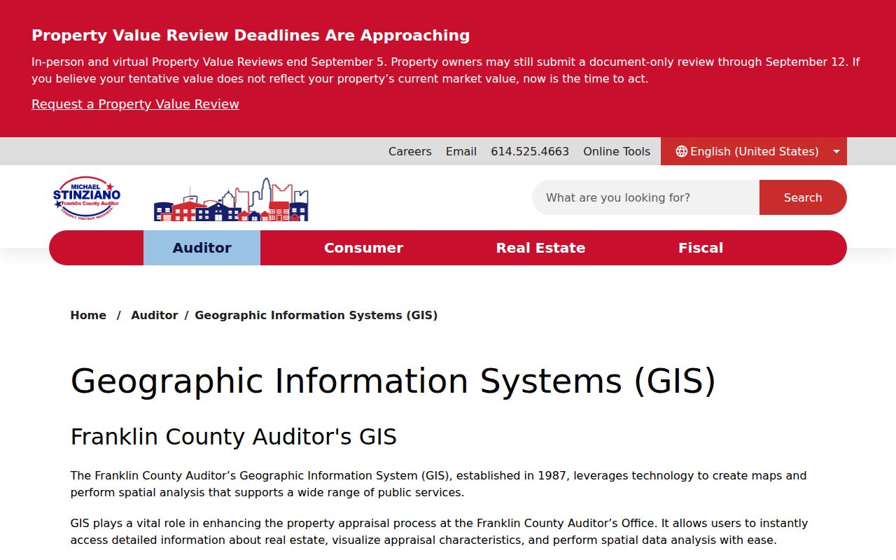
The GIS entry point leads to Parcel Viewer, where an identified parcel can be mapped and checked against visible layers before a City-label conclusion is made.
Upper Arlington Postal Parcel Comparison
A postal label, a property record, and a map layer can all describe the same address differently because they serve different systems. Compare them by the question being asked, not by which one looks most familiar. This Upper Arlington distinction is especially clear where the verified post-office label uses a Columbus postal city while City-address examples use Upper Arlington.
| Source | Best use | It does not decide |
|---|---|---|
| USPS address result | Exact mailing format and delivery ZIP | City limits, parcel ownership, or annexation |
| Auditor property detail | Parcel identity, situs, property and transfer context | Postal formatting or a complete household list |
| Parcel Viewer | Mapped parcel, visible boundaries, annexation layer, and spatial context | Final postal address or recorded deed history |
This comparison keeps an Upper Arlington mailing question from becoming an unsupported claim about jurisdiction or occupancy.
Upper Arlington Address Keys
Different Upper Arlington record systems use different keys. The situs is the physical location of a parcel used in property and map research. A mailing address is where a tax notice or other correspondence is sent, and it can differ from the situs without proving who occupies the property. A legal description is the lot, subdivision, condominium, parcel, or other land identifier used in recorded-land work. ZIP is a fourth, postal key.
The Auditor can search by address, owner name, or parcel number. The Treasurer accepts name, street address, or parcel ID. The Recorder can work from documents that include a parcel number but does not index a street address. GIS locates parcels spatially. Keeping the keys separate prevents a mailing label from being mistaken for occupancy, a ZIP from being mistaken for City jurisdiction, or a street label from being mistaken for a Recorder search field.
Note: Record the ZIP beside the parcel ID and legal description, but let the custodian’s own record key control each search.
Upper Arlington ZIP History
Historic directories and telephone books predate five-digit ZIPs, so they should be searched by the address as it appeared at the time. Columbus Metropolitan Library says its city directories are annual from 1841 and include a street-address section beginning in 1911. The digitized 1926 telephone directory is arranged by street name, and the researched 1935 Ohio Bell directory explicitly includes Upper Arlington. Those materials can provide a dated address clue, not a retroactive ZIP.
For early property context, Upper Arlington developed from Perry Township land and incorporated in 1918. Historic maps, plats, and Recorder legal descriptions can be more useful than trying to fit a later postal boundary onto an old address. No Citywide ZIP realignment was verified in the research, so no such change should be assumed.
Upper Arlington Property Timing
Franklin County’s 2026 Auditor system upgrade can make Property Search slow or return limited or no results while data entry resumes. A temporary no-result is not proof that a parcel or address is absent. Retry after an update, then use Parcel Viewer, the Treasurer property search, Recorder search, or the appropriate county counter to continue the record trail.
That difference in tools is useful by design: Auditor Property Search is the property location channel, Recorder Cloud Search is the recorded-instrument channel, Parcel Viewer is the map and adjacency channel, and CML materials are historic listing sources. A ZIP code directory becomes more reliable when each source is used for the question it actually answers.
Upper Arlington’s Quick Links also point to Franklin County Property Search and GIS Mapping alongside City records channels. If a parcel map, postal result, and municipal label seem inconsistent, preserve the result dates and ask the responsible custodian about the specific record. That is more dependable than treating a temporary system response or a postal label as a final boundary decision.
Upper Arlington Postal Limits
A ZIP is a postal delivery geography, not an Upper Arlington city boundary. The same distinction appears in the verified post-office label, which uses COLUMBUS, OH 43221-9998 even though the office is identified as the Upper Arlington Post Office. Use City documentation and parcel mapping for municipal context, and USPS for the exact delivery address. Do not infer an annexation, City limit, or property ownership from the five-digit ZIP alone.
- ZIP and ZIP+4
- The five-digit ZIP identifies a postal area. ZIP+4 adds a delivery-level segment, so it should be confirmed through USPS for the individual address.
- PO Box ZIP
- A ZIP used for post-office boxes can differ from nearby street delivery geography. No PO Box-only Upper Arlington ZIP is asserted here.
- Unique ZIP
- A ZIP assigned to a single organization or large recipient. No such Upper Arlington ZIP was verified in the research.
- Carrier route
- A postal delivery grouping used to organize delivery work. It is not a City boundary or a resident directory.